


Allston I-90 "540 Comments"
March 5, 2018
“Comments expressing an opinion on the Throat Area alternatives heavily favored the at-grade alternative conceptualized by A Better City.” So said the MEPA Certificate signed by Secretary of Energy and Environment Matthew Beacon that summarizes the responses to the Draft Environmental Impact Report prepared for the I-90 Allston Interchange. MEPA received 540 comments on the 600 page report, demonstrating a high level of interest not only among the agencies and organizations focused on the project, but among members of the public who live near the site primarily in Allston, Cambridge, and Brookline.
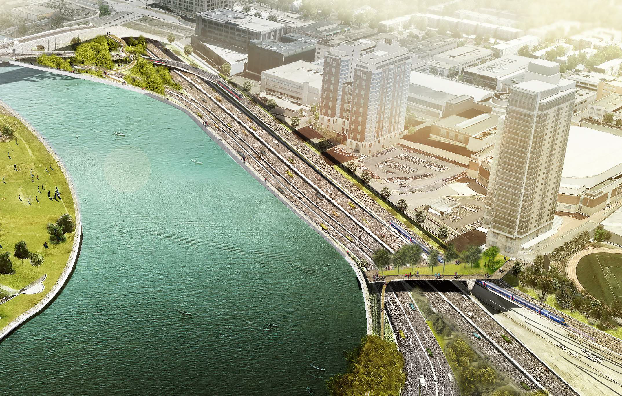
The overall site is located at a bend in the Charles River and is currently owned by Harvard University. The “Throat Area” is the 1,200 foot long, 220 foot wide corridor between the edge of the river and the property line of Boston University. The overall site accommodates eight Turnpike travel lanes – part of the way on a viaduct that is deteriorating, four lanes of Soldiers Field Road, multiple lanes of major streets and ramps that connect these streets to and from the Turnpike, narrow bike and pedestrian paths, two active rail tracks between South Station and Worcester (and beyond), tracks that connect rail systems north and south of the river and provide freight service, an abandoned rail yard, and acres of very accessible land with the potential to provide that “once in a generation” opportunity to build something grand.
Last year, the toll booths at the Allston Interchange were removed and were replaced by All Electronic Toll gantries near the BU Bridge and west of Cambridge Street. The former rail yard tracks have been removed, and soon the spur that supports rail deliveries to the Houghton Chemical plant will be removed allowing the present Turnpike curve to be straightened a bit, and opening the opportunity for a flat and level Turnpike right-of-way running the entire distance from under reconstructed Commonwealth Avenue and the BU Bridge to the bridge that carries Cambridge Street overhead.
This flat, straightened, safer, less noisy highway alignment along with the train tracks that also stay mostly at grade provide an opportunity to eliminate the viaduct barrier in the Throat Area that separates most of the neighborhoods from the river. It provides an opportunity to bridge over the transportation facilities at several locations so that more people will have a more direct path to the river. With the highway reconstructed at grade, it would be easier to build, disrupt roadway and rail operations to a minimum during construction, and would cost less to build and less to maintain over its lifespan than other alternatives being considered.
There are several other improvements in and around this site that the neighbors would like to see built including more and better parkland, better crosstown bus connections, and a new rail stop called West Station. A Better City has advocated for all of these elements in the 50 member Task Force established for this project and in other venues. We “conceptualized” the money saving All At-Grade alternative that was included in the environmental report, and that received most support among those who commented on that part of the design. This less costly option could allow funds to support these other items.
The All At-Grade option is a series of compromises about widths, about the amount of open space, and whether or not there is impact on the edge of the river. All of these issues and more can and should be discussed in greater depth as the Draft report is developed into the Final environmental report over the course of this year. The discussions will continue.
Authored by: Tom Nally, Planning Director
tnally@abettercity.org